
Archived decisions
Hampshire County Council
Regulatory Committee Item 17
23 May 2007
Proposal to record a byway open to all traffic in the Parishes of Penton Grafton, Monxton and Amport
Report of the Director of Recreation and Heritage
Contact: Alex Lewis, extn. 6044; [email protected]
WILDLIFE AND COUNTRYSIDE ACT 1981
53. Duty to keep definitive map and statement under continuous review
(2) As regards every definitive map and statement, the surveying authority shall keep the map and statement under continuous review and as soon as reasonable practicable after the occurrence .... of any of [the events specified in sub-section (3)] by order make such modifications to the map and statement as appear to them to be requisite in consequence of the occurrence of that event
(3) The events referred to in sub-section (2) are as follows -
(c) the discovery by the authority of evidence which (when considered with all other relevant evidence available to them) shows:-
(i) that a right of way not shown in the map and statement subsists or is reasonably alleged to subsist over land in the area to which the map relates, being a right of way to which this Part applies
NATURAL ENVIRONMENT AND RURAL COMMUNITIES ACT 2006
67. Ending of certain existing unrecorded public rights of way
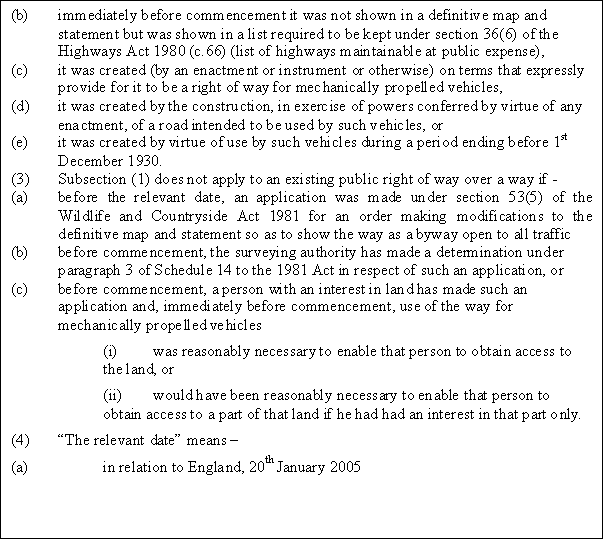
(1) An existing public right of way for mechanically propelled vehicles is extinguished if it is over a way which, immediately before commencement -
(a) was not shown in a definitive map and statement, or
(b) was shown in a definitive map and statement only as a footpath, bridleway or restricted byway.
But this is subject to subsections (2) to (8)
(2) Subsection (1) does not apply to an existing public right of way if -
(a) it is over a way whose main lawful use by the public during the period of 5 years ending with commencement was use for mechanically propelled vehicles,
(b) immediately before commencement it was not shown in a definitive map and statement but was shown in a list required to be kept under section 36(6) of the Highways Act 1980 (c.66) (list of highways maintainable at public expense),
(c) it was created (by an enactment or instrument or otherwise) on terms that expressly provide for it to be a right of way for mechanically propelled vehicles,
(d) it was created by the construction, in exercise of powers conferred by virtue of any enactment, of a road intended to be used by such vehicles, or
(e) it was created by virtue of use by such vehicles during a period ending before 1st December 1930.
1. Summary
1.1 Members are requested to agree to the making of a Map Modification Order to add to the definitive map a byway open to all traffic between Monxton Lane in the parish of Monxton and Red Post Lane in the parish of Amport (shown between the points A - B on the attached plan). The highway was constructed as part of the improvements to the A303 trunk road and motorised vehicular rights over the road are considered to be exempt from extinguishment by the Natural Environment and Rural Communities Act 2006.
2. Recommendation
That Members approve the making of an order to add a byway open to all traffic to the definitive map between points A and B on the attached plan.
3. Background
3.1 This item has been prompted by the on-going work of the Rights of Way Section in updating the definitive map prior to publication of a new, up-to-date map of the rights of way in the County.
3.2 Before a new definitive map can be published, the existing map must be updated, by legal orders, to take account of all the changes to the network that have happened since the original date of publication (in Hampshire's case, 1964). This is because diversion or extinguishment orders, or dedications, (Highways Act, or `Public Path', orders, of the sort that this Committee is asked to approve from time to time) legitimate a change to the network, but do not automatically update the definitive map. A separate order is need to do this.
3.3 Byways open to all traffic can only be added to the definitive map as a result of an evidential map modification order, even if, as in the present case, the origins of the path lie with a side roads order made by the Secretary of State for Transport. This report, therefore, seeks consent to the making of an order under S.53(3)(c)(i), i.e. an order based on evidence that a byway open to all traffic subsists, or is reasonably alleged to subsist, on the route shown between A - B on the attached plan.
3.4 The route has been shown for many years on the working copy definitive map held at the rights of way office, and is already shown as a byway open to all traffic on the Ordnance Survey Explorer map of the area. It is recorded on the list of highways maintainable at public expense kept by the Environment Department under s.36(6) Highways Act 1980.
4, The Side Roads Order
The relevant side roads order is entitled `The London - Penzance Trunk Road (Andover - Thruxton Section Side Roads) (No. 3) Order 1983 and is dated 18th August 1983. The A303 bisected a byway known as Monxton Lane and created two dead-end highways. This order created a new highway, running parallel with, but to the south of the A303, which connects Monxton Lane (Monxton BOAT 11) with a road known as Red Post Lane. The new highway is described in the order as a road. The order provides that the road will be transferred to the County Council after construction. The land on which the road was constructed is unregistered, but is believed to have been the subject of a compulsory purchase order and to belong to Highways Agency. The land is not registered at HM land Registry. The route is currently, and was on 2nd May 2006, recorded on the county's List of Streets with the classification given to unsurfaced carriage roads.
5. The route of the dedicated highway
The path is approximately 650 metres long. It has a surface of compacted scalpings, which is suitable for occasional motor vehicular use. It has a consistent width of 6.10 metres (20 feet).
6. The balance of user
6.1 Only those public vehicular highways that are used primarily as footpaths and bridleways should be recorded on the definitive map. Although it was once considered necessary to have proof that actual use by walkers and riders exceeded use by the public in vehicles (and, therefore, that you must be able to prove that walkers and riders were using the route), it is now no longer necessary to do so. Roch LJ giving the leading judgment in Masters v Secretary of State for the Environment Transport and the Regions considered the test to be one of character: "What was being defined [in s.66(1) Wildlife and Countryside Act 1981] was the concept or character of such a way." Section 66 includes the definition of a byway open to all traffic. i.e. `a highway over which the public has a right of way for vehicular and all other kinds of traffic, but which is used by the public mainly for the purpose for which footpaths and bridleways are so used'.
6.2 The character of the route is such that it is more suitable for walkers and riders than for vehicular traffic and it is thought that it was intended to have been used primarily by walkers and riders (correspondence suggests that it had originally been intended to be a bridleway, but representations from the County Council caused it to be created as a road, so as not to leave Monxton Lane as a vehicular cul-de-sac). No further research as to the type or amount of public use has been carried out.
7. Consultation
7.1 The Highways Agency, Test Valley Borough Council, Amport, Monxton and Penton Grafton Parish Councils, the Ramblers' Association, British Horse Society, the Trail Riders Fellowship, LARA have been consulted and comments have also been invited from the Environment Department and the Area Officer. The local member, Patricia West has been informed.
7.2 The British Horse Society believes that the road is eminently suitable as a riding route and of limited value for motor vehicles, and points out that local people had already considered it to be a byway. They have no objection to the proposal as long as the road remains free of tarmac.
7.3 LARA (the Land Access and Recreation Association) states that it welcomes the additional of the route to the definitive map and that it is a hard and sustainable route which has been used by their members.
7.4 The Ramblers' Association has no objection to the proposal to record this track as a byway open to all traffic.
8. Future management
The path has been available to all users for in excess of 20 years and remains in perfectly acceptable condition as a rural byway. It is not considered necessary to take any preventative action to regulate or restrict use in the immediate future. The position can be reviewed at any time should the condition of the path or the amount of use change.
9. The Natural Environment and Rural Communities Act 2006
9.1 If members accept that the route was created as a highway for the public in vehicles it is necessary to consider whether the `motorised' element of that right of way has been extinguished by the Natural Environment and Rural Communities Act 2006 (NERC). The right of way for mechanically propelled vehicles will have been extinguished by s.67(1) of that Act, unless one of the exceptions in s.67(2) applies.
9.2 Officers consider that the right of way falls within the exceptions set out in s.67(2)(b) and s.67(2)(d). On 2nd May 2006 the way was recorded on the List of Streets (as 74 T59 BB) but not on the definitive map. The right of way for mechanically propelled vehicles was also created by the construction, in exercise of powers conferred by s.14 Highways Act 1980, of a road intended to be used by such vehicles. Section 14 authorises the construction by the Secretary of State of new highways associated with works being carried out to a trunk road.
10. Conclusions
The track between A and B on the attached plan was constructed by the Secretary of State as part of the A303 improvement works west of Andover. The right of way for mechanically propelled vehicles has not been extinguished by NERC, and the character of the way is such that it ought properly to be recorded as a byway open to all traffic.
Section 100D - Local Government Act 1972 - background papers
No documents have been relied on in the preparation of this report that are not (1) published works and (2) documents which disclose exempt or confidential information as defined in the Act.
15/05/2007