
Archived decisions
Hampshire County Council
Regulatory Committee Item 16
25 June 2008
Application for a Definitive Map Modification Order for the addition to the Definitive Map of footpaths at Bushfield Camp and Bushfield Down in Winchester City and in the parish of Compton and Shawford
Report of the Director of Recreation and Heritage
Contact: Alex Lewis, extn. 6044; [email protected]
WILDLIFE AND COUNTRYSIDE ACT 1981
53. Duty to keep definitive map and statement under continuous review
(2) As regards every definitive map and statement, the surveying authority shall keep the map and statement under continuous review and as soon as reasonable practicable after the occurrence .... of any of [the events specified in sub-section (3)] by order make such modifications to the map and statement as appear to them to be requisite in consequence of the occurrence of that event
(3) The events referred to in sub-section (2) are as follows -
(b) the expiration, in relation to any way in the area to which the map relates, of any period such that the enjoyment by the public of the way during that period raises a presumption that the way has been dedicated as a public path;
(c) the discovery by the authority of evidence which (when considered with all other relevant evidence available to them) shows:-
(i) that a right of way not shown in the map and statement subsists or is reasonably alleged to subsist over land in the area to which the map relates, being a right of way to which this Part applies
HIGHWAYS ACT 1981
s.31 Dedication of way as a highway presumed after public use for 20 years
(1) Where a way over any land, other than a way of such a character that use of it by the public could not give rise at common law to any presumption of dedication, has been actually enjoyed by the public as of right and without interruption for a full period of 20 years, the way is to be deemed to have been dedicated as a highway unless there is sufficient evidence that there was no intention during that period to dedicate it.
(2) The period of 20 years referred to in subsection (1) above is to be calculated retrospectively from the date when the right of the public to use the way is brought into question, whether by a notice such as is mentioned in subsection (3) below or otherwise.
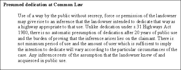
Presumed dedication at Common Law
Use of a way by the public without secrecy, force or permission of the landowner may give rise to an inference that the landowner intended to dedicate that way as a highway appropriate to that use. Unlike dedication under s.31 Highways Act 1980, there is no automatic presumption of
Presumed dedication at Common Law
1. Summary
1.1 This item considers an application to add to the definitive map a number of interconnecting footpaths running over land known as Bushfield, which lies to the south of St. Cross, Winchester. The application is based on evidence of user.
1.2 The claim is recommended for refusal, on the grounds set out in paragraph 2.
2. RECOMMENDATION
2.1 No order should be made because the use made of the land over which the claimed paths run is predominantly as an open space, for general recreation, which includes walking. It has not been possible to distinguish any single route, or number of routes within the land which are used predominantly as highways.
3. Description of the claimed path
3.1 The claimed paths are shown on a map which accompanied the application and which is shown at Appendix 1. This is a fair, although not completely accurate, representation of the paths that currently appear on the ground. Appendix 2 shows the claimed paths superimposed on a contemporary Ordnance Survey map. The land over which the claimed paths run is triangular in shape and lies between Whiteshute Lane (Compton and Shawford Restricted Byway 35) in the west, the Winchester - Southampton railway line in the east and Badger Farm Road in the south. The residential area, Badger Farm, lies in close proximity to the west.
3.2 The whole area of land is loosely referred to as Bushfield Camp, but it can be divided into three areas, each of which has a distinct character.
3.2.1 'The Camp'
In the south and coloured green on Appendix 2 is Bushfield Camp, the site of a former army camp. The claimed paths in this area follow the tarmacadam paths and drives which surrounded the buildings which used to exist on the site. They are relatively easy to identify (see our representation of these on the plan at Appendix 2). There is a barrier across the path at the Badger Farm entrance to the site, although pedestrians can squeeze to one side. There are `Stop' notices here, one facing in each direction and a newish notice which says `Private Property. No Public Right of Way'.
3.2.2 'The Down'
The land immediately to the north of the Camp is known as Bushfield Down and is shown coloured pink on the map at Appendix 2. This has not been cultivated for some years and is currently grazed seasonally. It consists of grass and areas of low bushes and impenetrable scrub. The claimed paths here are harder to plot because Ordnance Survey base mapping does not show any features against which the paths can be referred. The claimed paths do not match exactly the paths currently in use. A plot of the paths which form the best match, taken with the help of a satellite positioning system giving sub-metre precision, is annexed at Appendix 3. The plot has been superimposed on aerial photography from 2005. Appendix 4 is the same map as Appendix 3 but showing, in addition, some significant paths which exist on the ground but which do not appear to form part of the claim.
3.2.3 'The Field'
To the north of Bushfield Down is an area of land which is cultivated from time to time and which was, in the past, used as allotments. It is shown coloured yellow on Appendix 2. The difference in character between the Field and the Down is clear on the photographs at Appendices 3 and 4. Appendices 3 and 4 show paths on the Field and well as the Down.
3.3 There are notices at points of access onto the Down and Field (a, b, c and d on Appendix 3) which were erected in 2003 and grant limited permissive rights of access to the Down and the Field. The paths on the Down and Field are visible on the ground, but of indeterminate width: it is clear that in some places users are confined to a narrow space between obstructions and in other places they are at liberty to wander over a wider area. All of the paths shown on the map at Appendix 4 were clear to follow in January 2008 and all showed signs of having been used by walkers. This last point may be significant, because there were also other paths (not plotted), which did not show signs of use by walkers and which may have been made by livestock, and not used by walkers.
3.4 The Camp and the Down are sites of importance for nature conservation (SINCs).
4. The Applicant and the Application
4.1 The Applicant is Mr Roderic Collins of Badger Farm. The application form is dated 17 June 2003. The application was accompanied by a sketch map of the claimed paths (Appendix 1) at an appropriate scale and a copy of the notice referred to in paragraph 8.1. User evidence forms followed piecemeal over a period of months, but are not referred to in the application as being documents on which the applicant relies. It would appear that the application has not been made in accordance with paragraph 1 of Schedule 14 to the Wildlife and Countryside Act 1981 because, although the certificate of service which was submitted with the application discloses that notice of the application was given to the Agents of the landowners, notice does not appear to have been given to the agricultural or business tenants who occupied the land at that time. Attempts have been made by officers to contact the tenants through the landowner's agents, and a letter from the tenant of the Field (since 1985) has been received, but it is not know whether any other tenant(s) aware of the application. It is recommended that, should members decide to make an order to add any one or more footpaths to the definitive map it is done under the County Council's s.53(2) powers, rather than as a determination under paragraph 3 of Schedule 14 of a validly made application.
4.2 The application was prompted by the erection by the landowner, in 2003, of stockproof fences around the Down, which were erected for the grazing and good husbandry of the Down but which prevented users from getting access to the Down and, from there, to the Camp and Field. A campaign group was formed by local residents which entered into negotiations with the landowner's agents. These resulted in the erection of stiles at four points in the perimeter fence and at points between the Field and the Down and permission being given to the public to use those areas on foot. Access to the Camp is not included in that permission. There is currently a great deal of public use of the Down and the Field.
5. The Landowner
5.1 The Church Commissioners own all of the land which is the subject of the claim. Represented by Cluttons, of Romsey, until 31 March 2008, they are now represented by Strutt and Parker of Salisbury and by Smiths Gore of Winchester. Most, but not all of the land is tenanted. Evidence given on behalf of the Church Commissioners is at paragraph 11.
6. Consultation
6.1 Letters of consultation have been sent to Winchester City Council, Badger Farm, Oliver's Battery and Compton and Shawford Parish Councils, Councillors Mrs C. Bailey and Mrs P. Peskett, the Ramblers' Association, Open Spaces Society, British Horse Society, and the Environment Group (Hampshire County Council).
6.2 Badger Farm Parish Council considers that the number of paths claimed over the camp is excessive and based on the old road layout of the camp rather than traditional footpaths. It considers that one, NW-SE path should suffice. Similar comments apply to the eastern part of the Down. The Parish Council welcomes the recognition of a limited number of the paths, but the current application is excessive.
6.3 The British Horse Society is unable to offer evidence of use of the land in question.
6.4 Hampshire County Council Environment Group has no comments.
6.5 Oliver's Battery Parish Council supports footpaths in the claimed areas being added to the definitive map.
6.6 The Ramblers' Association would be pleased to see any additional rights of way that may be proved, but has no specific evidence to offer. It acknowledges that use of the area may have been akin to a `Freedom to Roam' area, rather than a highway. The track which joins Badger Farm Road might be viable because it is the only exit from the whole area onto that road.
6.7 Councillor Bailey supports the claim and has provided evidence from an additional user who has walked on Bushfield Camp for 32 years.
7 The issue to be decided
7.1 This Committee is required to decide whether or not the evidence described in this report shows that one or more public footpaths subsist, or are reasonably alleged to subsist, as claimed, or at all, across the Camp, Down and Field. There is no evidence of an express dedication of the paths by the landowner, but Members are, nonetheless, entitled to find that there was a dedication if the evidence points to use of the paths by the public and the landowner's acquiescence in that use. Members should find that there was a dedication if the requirements of s.31 Highways Act 1980 are satisfied in respect of one or more paths.
7.2 A public right of way is a right to pass and re-pass over a defined route, normally (although not necessarily) one which links two other highways, or which leads to a place of public resort. Wandering at will over an area of land will not result in the deemed dedication of that land as a highway. It does not matter if the purpose of the passing and re-passing is for recreation, but recreating on a piece of land is not use of it as a highway.
7.3 The burden of proof in these matters is `on the balance of probabilities', so it is not necessary for evidence to be conclusive before a change to the definitive map can be made. If there is genuine conflict in the evidence, for example between the evidence of users on the one hand and the evidence of the landowners on the other, an order should be made, but officers do not consider that there is such a conflict of evidence in this case.
7.4 Members should not be constrained when making their decision by the paths claimed: if there is evidence that paths subsist or are reasonably alleged to subsist Members are entitled to authorise the making of an order even if the paths concerned have not been claimed.
7.5 Copies of the maps, photographs, statements, user evidence forms and other documents can be inspected in the Rights of Way office, Mottisfont Court. Members are urged to inspect these when considering this report.
8. The evidence submitted by the Applicant
8.1 The application was accompanied by a hand drawn map of the claimed routes, a copy letter to the Church Commissioners informing them of the application and a copy of a notice erected at Bushfield, suggesting to its users that they contact Hampshire County Council to protect their rights. The notice is in the following terms:
"Bushfield Camp - Rights of Way
Do you feel that your rights of way are being affected by the recent enclosure of fields on Bushfield Camp by barbed wire fencing?
Whilst it is accepted that the owners of the land and their tenants have the right to manage the land as they think fit, it is unreasonable, if not illegal, to obstruct rights of way that have been acquired over the years to walk across the land.
There are may well-worn tracks across Bushfield Camp that have been used by the public for many years, No provision has been made in respect of public access but you can do something to protect your rights.
Please contact
Rachael Hawkes on 01962 845 924
Hampshire County Council Countryside Service
and request a rights of way claim pack.
It may take some time to process the claim to have the "Definitive Map" modified but in the meantime Hampshire County Council will have to take notice of the Public Interest expressed and negotiate safe access for the public."
8.2 These documents do not provide adequate or, indeed, any evidence of the existence of any public rights of way across the Camp, Down and Field. Between July and October 2003, following the posting of the notice on the relevant land, 48 witness evidence forms were received by the Rights of Way Section and it was also provided with a petition with 130 signatories which had originally been sent to Mark Oaten, MP. In addition, officers have considered other documents and evidence as set out below.
9. Historic and Documentary Evidence
9.1 There is no evidence that any of the claimed routes has ancient or historic origins. None of the four editions of the Ordnance Survey County Series Maps (between approximately 1870 and 1930) show any of the paths. The area is generally featureless, apart from field boundaries, although the three later editions show that the Field was set out as allotment gardens. The boundary between the Down and the Field is not shown on its present alignment.
9.2 A 1964 edition National Grid map (with survey/revision dates between 1951 and 1963) shows the roads and buildings of the Camp, but none of the claimed routes over the Down and the Field. This suggests that these are relatively recent features. In contrast, Footpaths 707 and 715 to the northwest of Whiteshute Lane are shown on all of these maps.
9.3 The ancient settlement of St Cross lies to the northeast of the Bushfield Camp area and Stanmore, (inter-war housing development) lies to the north. Badger Farm, a significant area of housing development lying to the west, was not constructed until the early 1980s. Until then, Bushfield Camp was surrounded by agricultural land on the west and south sides. The public had access to the general area along Whiteshute Lane and a parallel footpath to the northwest (Footpaths 707 and 715) but there are no other recorded rights of way in the immediate area. Before Badger Farm was built any users of the land are likely to have come from St. Cross or Stanmore and perhaps later from Olivers Battery. The construction of Badger Farm will have increased pressure on this open space from the early to mid 1980s, a fact borne out by the evidence considered below.
9.4 Rights of way files show that a plan and statement dated 20 August 1997 was deposited by the landowner under s.31(6) Highways Act 1980. A statutory declaration under the same legislation was received by the Chief Executive on 18 August 2003. The effect of this declaration is to prevent any presumption of dedication arising which relies on a period of use after 20th August 1997.
10. Evidence of recent user
10.1 Aerial photography
10.1.1 Black and white 1:10,000 aerial photography is available from 1971 and 1984. There are lines on the 1971 photograph which may, or may not, represent paths, within the Down, which follow the boundary with the Field. One also runs diagonally across the Down on an alignment that does not exist as a path today. No paths are visible across the Field. In contrast to the position later, the Down is clear of vegetation and appears cultivated but the Field is not. In contrast, the 1984 photograph shows that the Down was then covered with scrub, and that the Field had been ploughed. This photograph shows that Badger Farm was in course of construction: about half of the land was developed, the remainder was a building site. Neither photograph provides evidence for the existence of any public rights of way across the Camp, Down or Field.
10.1.2 Colour 1:10,000 aerial photography taken in 1991 shows the Field in cultivation and the Down partially covered in scrub. This photograph shows some distinct lines, which may have been worn or trodden paths running over the Down, two of which are in approximately the position of Path 2 and Paths 11 and 12 (see map at Appendix 3). The other is present only in part today - between Path 8 and Path 13. This photograph does not provide evidence that these lines were made by the public exercising a right (or putative right) to walk on the land, but they are consistent with there being some degree of public access to the land at this time.
10.1.3 Colour photography taken in 2000 shows more paths and tracks across the Down and the Field. It is possible to see Paths 1 - 14 (with the probable exception of Path 2) or, at least, tracks on approximately those lines. Other paths are also visible. A similar picture is seen on aerial photography taken in 2005.
10.1.4 The paths on the Camp are consistently shown on all photographs because they are tarmacadam drives. The 1971 photograph shows Camp as it must have been when operational and before the construction of Badger Farm Road. By the time the 1984 photograph was taken, many of the buildings on the Camp had been demolished and Badger Farm Road was on its current alignment.
10.1.5 In summary,
· the photography supports the assertion that there were paths on, or approximately on, the routes 1 - 14 by 2000;
· the earlier photography does not assist the claim greatly although there is some evidence that a few paths existed by 1991. This means either, that there was no use being made of the other paths or that the use was not sufficiently intensive to leave any trace on the ground (or, in the case of the Field, that they had been ploughed out);
· the 2000 and 2005 photographs show paths other than those claimed;
· none of the photographs provide evidence that the paths were made by members of the public using them as of right, but they do provide corroborative evidence of the fact of use, since 1991 for paths 1, 2, 3, 11 and 12, and at least 2000 for the remainder.
10.2 Users' Petition
10.2.1 A petition containing 130 signatures, dated 20 September 2003 and headed `Open letter to Mark Oaten MP' was forwarded to the rights of way section by Mark Oaten. This was shortly after barbed wire fencing had been erected around Bushfield Down. The fencing restricted public access to the Down and impeded access from there into the Camp and Field. Six points are made under the heading `Bushfield Camp and the surrounding downland'. These include:
"1. All of us in the area have had unrestricted access to the area, in many cases for more than 20 years...
3. Through many years of neglect, this land has become a natural haven for flora and fauna, and a treasure for us humans. We believe that grazing by cattle need not destroy these qualities, but only if it is sensitively managed...
5. We have been told by the owner's agent that the only purpose of the fencing is to `keep animals in and humans out'. In that case, does it have to be so aggressively high and barbed? We have come to believe that obstruction to the legal right to roam (under the CROW Act) or even building development are parts of a "hidden agenda" for the area.
6. Finally we feel that proper concern must be given to the view of Winchester City Council who reported that they were "determined to sustain uses for the Bushfield Area which maximise the site's potential for sustainable public access". They went on to say in their Report dated December 1997 that "sporting and recreational benefits are entirely appropriate and should be pursued to the utmost extent".
Permissive access to the Down and the Field was later granted by the landowners.
10.3 User evidence forms
10.3.1 The user evidence forms show use since 1950, although the majority of use is much later. There is evidence of use in 1970 from 3 people. By 1980 there is evidence from 13 users, and use increases again to 22 in 1985, 36 in 1995 and 41 in 2003. A graph showing the number of users and their period of use is annexed at Appendix 5. This graph is, of necessity, a generalisation, but it will give an idea of the volume of use of the land and the trend in usage, which is significant. According to the user evidence forms, the amount of use varies, between twice a year and twice daily.
10.3.2 The majority of the user evidence forms were accompanied by a sketch map similar to that which accompanies the claim, and which suffers from the same lack of precision, particularly with regard to the paths over the Down and the Field. The forms do not lend themselves easily to the provision of more detailed information about each individual path or link and, predictably, the witnesses themselves are not precise about exactly which paths were used, when, and how often. Because most people seem to have varied their walks, it is highly unlikely that all paths were walked on each occasion of use.
10.3.3 In order to clarify exactly which paths the witnesses used over the Down and the Field, a number of users were sent a supplementary questionnaire which included a copy of the map at Appendix 3 and which asked a number of questions, including `Which of the paths have you used?' and `Which have you used most often?'. 20 survey replies were received. The only path used by all 20 respondents is 11; the paths with least use were 7 and 15. No path, or paths, stand out as having significantly more use than others.
10.3.4 Seven users have been interviewed and their evidence is as follows:
10.3.4.1 Roderic Collins is the claimant. He has lived in Badger Farm since 1983, in one of the first houses to be built on the estate. Land to the east of Whiteshute Ridge was an obvious place for his family members to take their dogs for exercise. Mr Collins confirms that the Camp was derelict when he first arrived, but that it was completely accessible. It was possible to move freely between the Camp, Bushfield Down and the Field. There were posts between the Down and the Field, where an old fence might have been, but no physical barriers in place. There were a number of points of access into the area and then he could just wander around the open countryside for a walk lasting between 30 and 60 minutes. There was a total feeling of freedom and no restriction on his access, so he assumed that the land was common land in the same way as Whiteshute Ridge and that it was in the same ownership. He did not see any notices to discourage access and always saw lots of other people there, both walkers and dog walkers.
10.3.4.2 Mr Collins used the Camp less than the Down and the Field, because the buildings there were less pleasant to walk around, there being broken glass and other debris lying around until the buildings were demolished in their entirety, a long time ago. There were always a number of paths to follow on the Down and Field. Mr Collins does not think that they have moved significantly. He has used all of them over the years. At first he went onto the land once a week, but over the last 10 years this has been 2 or 3 times a week. His children have gone onto the land with their bikes, to play. They have also looked for old bullets by the firing range and built jumps for their BMX bikes. Other people go there to watch birds or to have picnics.
10.3.4.3 Things changed in April or May 2003, when a contractor went round the perimeter of the Down with a flail, chopping down vegetation. Some trees were pulled down across Paths 5 and 6. Within weeks a barbed wire fence had been put up around the Down. The fence kept being cut by other people. Mr Collins put up notices encouraging people to contact us (see paragraph 8.1). Mr Collins was part of the group which campaigned for, and eventually secured, the present permissive access to the land.
10.3.4.4 Barbara Guthrie believes that a friend first took her to Bushfield in 1983, a year before she moved to Stanmore. She used to take her children to the Down regularly thereafter - say 3 or 4 times a week. Her family has since used the land for walking the dog, picking blackberries and elderflowers, kite flying, and tobogganing when it snowed. Her children took their bikes up there, as did others. As a family they had tracked animals and made plaster casts of their footprints.
10.3.4.5 In 1996 the family got a dog which Mrs Guthrie used to walk on the Down every morning. Her daughter would walk it in the afternoons. There was a respite in 2001/2002, when Mrs Guthrie only walked on the Down 3 or 4 times a week, but since 2002 she has again walked there every day. She has walked on all the claimed paths, but has used paths 1, 2, 3, 5, 6, 8 11 and 13 most often. Her route has varied. There are also tracks or shortcuts between the paths claimed. Mrs Guthrie says that she was fascinated by how many paths and ways had been used across the Down.
10.3.4.6 No one told Mrs Guthrie that Bushfield was private, and no one tried to stop her going there until 2003. In the Spring of that year she saw caterpillar machines being used to cut down hedgerows and clear undergrowth. Within a day or two a fence had been erected around the Down, preventing access. Some people cut the fences which meant that she could get access, but Mrs Guthrie and others wanted their right to use the land recognised. She joined the campaign group and was under the impression that it was agreed that the Down would not be built on, although no such agreement was given in respect of the Field. Until then, she never had permission from anyone to use the land.
10.3.4.7 John Leonard lived in St. Cross between 1976 and 2006. In 1976 the land which is now Badger Farm was just bushes and shrubs. His family used to walk over land on both sides of Whiteshute Ridge (although primarily on the northwest of the Ridge) until Badger Farm was developed. He did not know who owned the land: it was a general recreational area, not actively farmed.
10.3.4.8 There has been no sign of any allotments on the Field since Mr Leonard has lived in the area. The difference between the Field and the Down has been minimal, both being rough scrub and wilderness. The Camp was not being used for military purposes in 1976. Part of it used to be used by the community for cricket and football, and the area therefore attracted children and parents from Olivers Battery. This was at about the same time as Badgers Farm was being developed.
10.3.4.9 There was use of the Camp, the Down and the Field even before Badgers Farm was built. In 1976 there was evidence of everyone using it as a recreational area. There were paths, but no gates. Mr Leonard tended to recognise people who lived in St. Cross, but people from Stanmore walked there too. There were no signs saying `Private Property' or anything like that. No one ever questioned or challenged his use of the land before 2003.
10.3.4.10 Mr Leonard has used all of the paths claimed on the Down and the Field and some paths which are not claimed. He does not consider that the paths have changed significantly since 1976, with the exception of Path 9, which was made after he arrived. Paths 9, 4 and 10 are the most trodden, but the paths parallel with Whiteshute Lane (1, 2 and 3) are also well used as are the paths which follow the boundary with the Camp (Paths 5 and 6). Mr Leonard doubts whether people wander off the paths much, because there are so many of them and they afford access to the whole area. He has also used the paths on the Camp, the paths there being more convenient to walk when it is muddy. His family's dogs were walked twice a day and between them they have walked over the claimed paths at least six times a week for over 20 years.
10.3.4.11 Mr Leonard has seen a lot of dog walkers, naturalists, some pedal cycles and horse riders, joggers, kite flying and sledging. He believes that the paths are used as through routes.
10.3.4.12 There was no evidence that the agents or landowners made any effort to restrict access until fences were put up in late 2002 or 2003. In 2003, permissive access to the land was given by Cluttons on behalf of the landowners and information posts erected to show the terms of the permission.
10.3.4.13 Irene Ashby used to visit the area, about four times a year between 1975 and 1992 and on each occasion walked on the Down and the Field. In 1992 she moved to the area to live and her use of the paths increased. She used paths on the Field almost every day and used to walk on the Down about every two weeks. She believes that some paths became inaccessible when the land was fenced in 2003. She claims to have used all of the paths and some paths which are not claimed and refers to others having been lost. Mrs Ashby says that there were no notices before those erected in 2003. She has never had permission to walk on the land.
10.3.4.14 Ann Bristow moved to Olivers Battery in 1970, before any development took place at Badgers Farm. At that time, there were still buildings at the Camp and the locals used to play football there. She and her children used to walk onto Whiteshute Ridge, cross Whiteshute Lane and use a path on the western boundary of the Down and Field (Paths 1, 2 and 3), parallel with Whiteshute Lane. She used this in preference to Whiteshute Lane itself, because that path was dingy, difficult underfoot and sometimes blocked by fallen trees. This was the quickest way to St. Cross, but if they were not in a hurry, their route across the Down would vary.
10.3.4 15 Mrs Bristow has used all of the claimed paths, and also a path which ran across the track which led to the Camp (this was just north of the present Badger Farm Road). Mrs Bristow used these paths about 3 or 4 times a week in the 1970s, and nearly every day in the 1980s. When she was on a mission she would used paths 1, 2 and 3, but, if not, she would go `meandering or exploring'. When dog walking she used all of the paths on the Camp and went `all over the place'. She used the paths slightly less in the 1990s. She believes that in the 1970s the layout of the paths on the Down was significantly different. The land was grazed then and there was less scrub than in later years. In the 1970s and 1980s people went off the paths and wandered everywhere. She has seen people kite flying, picking blackberries and sloes, watching glow-worms, horse riding, practising falconry, tobogganing and nature watching. It is rare that she doesn't see anyone on the Down. Mrs Bristow has no connection with the landowner and has not been given permission to walk there, prior to the notices going up in 2003.
10.3.4.16 Annie Goodchild lived in Stanmore between 1972 and 1982 and then moved to Badger Farm. She has used the paths over Whiteshute Ridge and Bushfield Camp (including the Down and Field) for the past 35 years. Her evidence is that you could walk wherever you wanted on land to the northeast and northwest of Whiteshute Ridge. Since Badger Farm was built, her use has been confined to Whiteshute Ridge and the Camp, Down and Field. Mrs Goodchild says that there have always been paths from Whiteshute Ridge, across the Whiteshute Lane to points `a' and `b' (on Appendix 3). The Camp was derelict in 1982. Her dog is walked every day and usually in the Bushfield area. Because of anti-social behaviour she uses the Down and Field more than the Camp. Nothing controlled where she went on her visits to the area and she has walked wherever she wanted for a certain length of time, using the paths in different combinations. She uses paths 5, 6 and 7 very regularly along with the other paths around the perimeter of the Down and Field. She uses another path which is not claimed and which bisects the Down. She has never seen any notices apart from those now erected on the land and previously never had permission to walk on the land.
10.3.4.17 David Snell has completed a user evidence form and been interviewed, but has not signed a statement. He lives in Stanmore and claims to have walked on the land on both sides of Whiteshute Lane before the development at Badger Farm and on the claimed paths since. His evidence is that the Field had ceased to be used for allotments by 1960, and that the Camp was in use until 1970, and not accessible to the public until afterwards. The army boys used to use the path next to the railway line to get to St. Cross. Mr Snell thinks that this path has moved a bit, westwards, but otherwise the paths have stayed much the same. As a child he used to go everywhere, using the paths, but also roaming a bit. As an adult he has used all the paths, to recreate on and around the land, to dog walk, or go birdwatching, not as a journey to anywhere else. He reckons he goes up to the area on most mornings. He has never had permission to use the paths, but took it for granted that he could.
11. Landowner's evidence
11.1 All of the land over which the claimed paths run is owned by the Church Commissioners. The Field has been owned by the Church Commissioners since the C19th. Bushfield Camp was acquired from the MOD in 1983. Bushfield Down was acquired from Ideal Homes in 1994. Most parts of the land are let under various agricultural tenancies, although parts of the Camp are managed in hand.
11.2 Cluttons have advised that for at least 15 years (i.e. since 1992) a sign has been maintained at the main entrance to the Camp from Badger Farm Road confirming that the property is private and that there is no public right of way. It would be highly irregular of the MOD to have abandoned the site without maintaining a proper security fence and security guards. When the site was inspected by a representative of Cluttons prior to its acquisition in 1983 by the Commissioners, fencing, locked gates and security controls were in place. Strutt and Parker advise that the original locked field gate at the Badger Farm entrance was replaced with the present, secure barrier in 2002, to prevent unlawful access to the site by travellers and to prevent fly tipping. Smiths Gore believe that some sort of gate would have been maintained at this entrance point during the army's occupation and ever since the Commissioners acquired the site in 1983. Smiths Gore also believe that a succession of signs have been erected around the whole site (i.e. the Camp the Down and the Field).
11.3 In 1997 a statement and plan showing acknowledged rights of way was deposited under s.31(6) Highways Act 1980, which confirms that no rights of way were acknowledged across the land at Bushfield. A deposit had already been made in 1995 in respect of the Camp only.
11.4 Strutt and Parker confirm that they have advised the tenants of the present application. Smiths Gore have forwarded a letter written by the tenant since 1985 of the Field. The Tenant advises that he cleared the Field of the redundant allotments, before fencing it and using it, initially for cattle grazing. On occasions he ran his cattle over the Down. Later, the Field was used for growing spring barley until 1993, since when it has been in set aside. It has been mown periodically. The tenant states that prior to 1993 he would ask people using the site to leave, but he acknowledges that trespass has occurred across the site for years. He contends that use has not been as of right, because between the mid 1980s and 1993, on one occasion or another, the whole of the Field and the Down has been fenced and access was seriously obstructed or denied. Smiths Gore conclude, from the tenant's evidence, that access to the Field was totally excluded for a sustained period of time and that access to the Down was obstructed for periods throughout the mid 1980s to early 1990s.
11.4 Smiths Gore make the further point that, as the boundaries of the site are clearly defined, access points must have been created by walkers who have broken down the fences and hedges over the years.
12. Summary of the main points of the evidence
12.1 There appears to have been some use of farmland east and west of Whiteshute Ridge, by residents of St. Cross, Stanmore and Olivers Battery, for recreation and walking before the construction of Badger Farm (see, for example, evidence of Mr Snell, Mrs Bristow and Mr Leonard). Access over the Camp was probably not available until after 1970 or thereabouts (Mr Snell).
12.2 The evidence of this, early, use is not sufficiently precise to pin it down to a particular route, or routes.
12.3 The Camp was sold by the MOD to the Church Commissioners in 1983.
12.4 Badger Farm was constructed between approximately 1982 and 1988 (see evidence of Mr Collins and aerial photograph of 1984). Use of paths over Bushfield Camp, Bushfield Down and the Field increased after this time, according to user evidence forms. However, the claimed paths over the Down and the Field are not documented on any Ordnance Survey maps, and most appear on aerial photographs only since 2000.
12.5 The amount of evidence of use of the claimed paths is not insignificant and one might safely presume a higher degree of use than has been captured on the user evidence forms submitted in support of the claim. Although there are references to use of the land by horses and bicycles, evidence of this type of use falls well short of the quality and quantity needed to support a presumption of dedication of a highway of a status higher than footpath.
12.6 With a large number of different routes being claimed over the Camp, Down and Field, it has been difficult to pin down the user evidence on a route specific basis. Witnesses refer to walking all, or many of the paths and continually varying the route of their walks: they refer to walking on the land (Camp, Down or Field) on a given number of occasions without being more specific about which routes were being walked, when. The questionnaire responses received do not identify any one or more routes as being significantly more used than others: rather the reverse. Of those paths on the Down and Field, Path 7 appears the least well used by a noticeable margin, but use seems to be spread relatively evenly between many of the others. Use of paths 1, 3, 4, 5, 9, 10 11 and 14 is at the higher end of the scale, use of paths 7, 15, 2, 6 and 8 at the lower end.
12.7 In 1997 a statement and plan was sent to the County Council under s.31(6) Highways Act 1980. This was followed within six years by a statutory declaration to the effect that no rights of way had been dedicated over the Camp, Down and Field since 1997. S.31(6) provides that this is sufficient evidence of a landowner's lack of intention to dedicate any highways after the date of the first deposit (i.e. between 1997 and 2003). According to the Landowner's agents, such a deposit had also been made in respect of the Bushfield Camp area in 1995, but no evidence of this paperwork has been found in the records kept by the Chief Executive. This first deposit was not followed by a statutory declaration within the requisite six years and is thus not sufficient evidence of a lack of intention to dedicate any highways.
12.8 There exists at the Badger Farm Road entrance to the Camp a notice indicating that the land is private and there is no right of way. According to Cluttons, this has been in place since 1992. Smiths Gore believe that there were similar notices elsewhere, but this view is not corroborated by users or any other independent evidence.
12.9 There is a structure at the entrance to the Camp which Smiths Gore believe replaced earlier structures. Structures are relevant in so far as they actually prevent access, which the present structure clearly does not.
12.10 The tenant of the Field claims to have asked people he saw on site to leave. He also claims that the Field and the Down were surrounded by stockproof fencing for periods between the mid 1980s and 1990s.
12.11 Fences were erected around the Down and Field in the spring of 2003, which temporarily prevented access to the paths on this land and those which were accessed from this land. Later in 2003, permissive access was granted by the landowners to the Down and the Field and stiles were erected in six places on the perimeter and within this land. Access continues on this basis.
13 Analysis of the claim and issues arising
13.1 The law will presume that a right of way has been dedicated to the public in the following circumstances (s.31 Highways Act 1980)
· the character of the path is such that it could give rise to a dedication at common law;
· it has been used by the public at large for a period of 20 years without interruption;
· there is an event which brings into question the right of the public to use the way (this sets the end of the relevant 20 year period);
· there is not sufficient evidence that there was no intention to dedicate the way as a highway.
13.2 There is little doubt that the right of the public to walk on the Down and Field was brought into question in 2003, when fencing was erected around the Down. This also impeded the free access from the Down onto the Camp and the Field. The most recent 20 year period to consider is, therefore, 1983 - 2003.
13.3 The filing with the County Council of a statutory declaration made on behalf of the Church Commissioners in 2003 prevents the presumption of dedication of a highway arising during a 20 year period which includes all or part of the period 1997 - 2003. This is because s.31(6) treats such a statutory declaration as sufficient evidence of a landowner's lack of intention to dedicate since the date of deposit of the plan and statement in 1997. The 2003 statutory declaration is of no effect in so far as it refers to a 1995 deposit made in respect of Bushfield Camp, because the statutory declaration was not lodged within the requisite six years after 1995. The Camp is, in any event, covered by the 1997 deposit.
13.4 A 20 year period ending in 1997 might give rise to a presumption of dedication, but there still needs to be an event which brings into question the right of the public to use the claimed paths and which sets the end point of the 20 year period. Typical events which bring into question the right of the public to use a way might be the erection of `Private' or Keep Out' notices, locking of gates or regular challenges to users. Here, however, the users say that their use of the paths had never been queried or challenged before 2003 and that there were no notices on the land indicating that there were no public rights of way there, although there is contrary evidence on this point. Smiths Gore refer to signs around the site, and the tenant refers to challenges which, if made on behalf of the landowner can be a sufficient bringing into question. Details of the former are insufficient to pin it down to a date and there is no evidence that the tenant's challenges resulted in it being brought home to the general public that their use was being questioned.
13.5 Smiths Gore argue that the 1995 and 1997 s.31(6) deposits are events which can act as a 'bringing into question'. Officers are not aware of any case law which establishes whether the deposit of a s.31(6) plan and statement can operate as an event which brings into question the right of the public to use a way (the point was avoided by the House of Lords in a recent case on a related matter). The 1997 deposit acknowledges the existence of certain rights of way across land owned by the Church Commissioners, but makes no comment about any other highways over the land. The denial of the existence of any other rights of way might be inferred from the context of the s.31(6) deposit, and thus bring into question the right of the public to use them, but it is certainly not express, nor does the legislation attribute any legal consequence to the deposit of the initial plan and statement.
13.6 If there is no event bringing into question the right of the public to use the paths, there can be no presumed dedication under s.31. If a contrary interpretation is adopted (i.e. proceeding on the assumption that the 1997 deposit is a bringing into question) it needs to be considered whether s.31 can give rise to a presumption of dedication as a result of use during the period 1977 - 1997. Five issues need further consideration.
13.7 Crown Land
13.7.1 S.31 does not apply to Crown land. The evidence of the Church Commissioners is that they acquired the Camp from the MOD in 1983 (and there is no contrary evidence on this point). Whilst s.31 cannot operate against the Crown, there seems to be no reason why a 20 year period of user cannot include a period when the path in question belonged to the Crown, provided that the 20 years ends after the Crown has disposed of it. This is because the presumption of dedication is made at the end of the 20 year period. In officers' opinion, the fact that the paths over the Camp belonged to the Crown in the period 1977 - 1983 is not fatal to the claim.
13.7.2 Nonetheless, the evidence put forward on behalf of the Church Commissioners is that the MOD maintained a notice on the land whilst it still belonged to them, and that it would be `highly irregular for such a site to be abandoned without the army maintaining a proper security fence and security guards'. This is not corroborated by an independent source but, if right, this must cast some doubt on the testimony of witnesses who say that they walked on paths in the camp prior to its disposal in 1983 and whether there is sufficient use of the paths on the camp the whole of the 20 year period prior to 1997 (or 1995, if there was an earlier deposit as claimed).
13.8 Extent of user
13.8.1 As the attached user graph suggests, use of the paths claimed has increased significantly since the Badger Farm Estate was completed. There is evidence from 10 users who say they used the paths in 1977, before the estate was built, whilst there were 31 by 1990 and 40 in 2000. In terms of volume of user, the applicant's case, is considerably weaker for the first few years of the 20 year period than it is during the later years. The tenant's assertion that the Field and, on occasions, the Down, were fenced between the mid 1980s and 1990s casts some doubt on the volume and quality of user. The fencing might have interrupted use, such that there is not a continuous period of 20 years or, if fences were broken down, use might have been by force and thus not as of right.
13.8.2 It is difficult to ascertain from the user evidence forms how much use was being made of the individual paths or links. The forms are not sufficiently precise for this information to be extracted, and indeed, even the witnesses who have been interviewed cannot give this information in a precise way, tending to refer to their use of the land for walking in general, rather than with reference to any specific path or paths, although most can, and do, identify their preferred walks. This issue is exemplified by one witness, who has written "I am enclosing a map with the area highlighted. It is impossible to mark the actual routes I walk because I follow a different path almost every walk I do. These paths zig-zag across the whole area and around the boundary of the land". The Down and the Field are highlighted on the map with this statement. The claim is weakened by this lack of specificity.
13.9 Location of paths
There is potentially conflicting evidence about whether the paths have moved significantly during their period of use. In respect of any that have, the claim will fail because the relevant 20 year period of use must relate to use of a path or paths in the same location throughout the 20 years. Mrs Bristow says `In the 1970s the layout of the paths was significantly different', but Mr Collins says `I don't think they have moved significantly over the years', a view which is supported by Mr Leonard (`The paths have not changed significantly since 1976'). The questionnaire asked if the paths had migrated, and the majority view is `No' or `Not much'. Changes do appear to have been made to some paths when the fencing was erected in 2003, but this is outside the relevant 20 year period. Neither Ordnance Survey maps nor aerial photographs assist. It might be anticipated that some of the smaller tracks and paths become overgrown and lines of deviation created, or they might be used seasonally, but there is little evidence to suggest that users have adopted a significantly different main network of paths over their period of use, or that the paths claimed are of very recent origin. The exception to this is Path 9: it appears to be well used now, but the evidence of Mr Leonard is that all paths were there in 1976, with the exception of path 9 which was made later, by a vehicle. It is possible that there had not been use of this path for a full 20 years before 1997. The issue of path `migration' is of most relevance to the paths on the Down and Field: the paths around the Camp are made up, and will not have moved over the years.
13.10 Nature of User
13.10.1 A public highway is a right to pass and re-pass over a defined route which leads from one definite place to another definite place. A right of way can be acquired through use of a path for dog-walking or recreational walking, but mere wandering, or roaming, at will over an area of land will not lead to the establishment of the whole of that land as a right of way. It may be evidence which, with other evidence leads to the registration of that land as a town or village green, but that is a separate issue and that is not what has been applied for here.
13.10.2 There might, nonetheless, be within an area of land used for general recreation and wandering, paths or routes that have been used as highways. The difficulty in this case, is determining whether the use of Bushfield Camp, Bushfield Down and the Field, as evidenced by the witnesses and documents, is capable of giving rise to the presumed dedication of one or more highways or whether the nature of the use of the land is, in reality, that of a public open space, for more general recreation (including walking).
The question has to be asked (and answered) because of the following:
· The claimed paths on the Down and Field are only the most significant of a larger number of tracks or paths used by visitors to the land which are easily visible. The more dense the network of tracks or paths, the more likely it is that the land has been used for general wandering and the less likely it is that the land, or any part, of it can be said to have been used as a highway. One respondent to the questionnaire, in reply to the question `Which paths have you used most often?' answered, `All - plus free roaming per your map' and this appears to be typical of a lot of the user.
· What is being described in the 130 signature petition sent to Mark Oaten MP in 2003 is a desire to have general access to the land, rather than the preservation of one or more highways to particular destinations. Witnesses re-inforce this: `In the 1970s and 1980s...people went off the paths and wandered everywhere' (Bristow), `There was a total feeling of freedom. There was no restriction on our access and we assumed that the land was common land in the same way as Whiteshute Ridge' (Collins), `You could go wherever you wanted. There were no restrictions and you could walk there for hours' (Goodchild). The land `is a very precious resource to the people of Olivers Battery, Badger Farm, Stanmore and St. Cross who use it for their recreation and well being...' (Guthrie) and `There was plenty of evidence of everyone using it as a recreational area' (Leonard).
· Witnesses have described the Down and Field (in particular) as being used for finding flowers, dog walking, spotting glow-worms, watching moths hatch, taking casts of animal prints, exploring, picnics, picking blackberries and sloes, horse riding, kite flying, tobogganing, practicing falconry and bird watching. These kinds of activity can all be associated with use of land as a public open space, or even a town or village green. Many witnesses have described their use of the claimed paths as being for dog walking, recreation, jogging, leisure, exercise and pleasure, all typical recreational uses of land. Whilst there is also evidence of use of the claimed paths for visiting friends, shopping, `visiting the city' and swimming, which suggests that use is being made of some of the paths as a through route in a way more typical of a highway network, this use seems to be incapable of separation from other use which is, essentially, access to an area of land for the purposes of walking over it. The results of the questionnaire (see paragraph above 10.3.3 above) should show if one or more paths were being used more extensively or in a different way than others, but no routes stand out as being significantly more popular than the others.
13.11 Evidence of a lack of intention to dedicate
13.11.1 It is only necessary to consider this part of s.31 if satisfied i) that the 1997/1995 deposit is a bringing into question (or, that there is another event bringing the right into question), ii) that the volume of use is sufficient to support a presumption of dedication throughout the 20 year period and iii) that the user is of a nature that is capable of being a highway.
13.11.2 Messrs Cluttons and Smiths Gore refer to security measures thought to have been taken by the MOD prior to their disposal of the site, the sign, which still exists, at the entrance to the Camp from Badger Farm Road. Smiths Gore refer to other (unspecified) signs at other (unspecified) locations. The sign now in place is capable of being sufficient evidence of a lack of intention to dedicate and clearly falls within the twenty year period if it was erected in 1992, as described by Cluttons. The users do not refer to this notice, but there were other approaches to the Down and Camp and it is not apparent from the evidence how many users approach the area from this point on Badger Farm Road. Given that there is only one `official' point of access to the Camp, the notice is probably sufficient to prevent a presumption of dedication arising in respect of the paths on the Camp, but it is harder to argue that it should also relate to the Down and the Field which are quite distinct areas, accessed from a number of different points. Without more information about other signs it is difficult to afford them similar weight, and so in respect of the Down and the Field, there is less evidence of the landowner having taken any steps prior to 1997 to show the public that they had no right to be on the land and that no rights of way should be assumed. The tenants challenges can, however, have this effect if carried out on behalf of the landowner, although the evidence of challenges here lacks the detail that would make the failure of the claim a foregone conclusion.
14. Conclusions in respect of s.31
14.1 An order adding one or more footpaths to the definitive map should be made if this Committee is satisfied, in respect of each path that,
· the 1997 deposit of a statement and plan (and/or, in the case of the Camp, the 1995 deposit) is an event bringing into question the right of the public to use the path, or there is another event to the same effect, and
· the volume of use of that path is sufficient to constitute use by the public at large throughout the whole of the period 1977 - 1997 (or, in the case of the Camp 1975 - 1995), and
· that use of the path(s) is, or are, as a highway(s) between one definite place and another definitive place and
· there is insufficient evidence during the period 1977 - 1997 (or, in the alternative, in the case of the Camp, 1975 - 1995) that the landowner did not intend to dedicate such paths as rights of way
The paths most likely to meet these tests are 1, 2, 3, 4, 5, 9, 10 and 13: they are amongst the most popular routes and can serve as though routes towards St.Cross and Winchester.
15 Common Law
Whether or not the tests found in s.31 apply, a dedication might be inferred from the fact of use and enjoyment of a way by the public as of right and the acquiescence in that use by the owner, who knows of it, but does not interrupt it. However, similar ground rules apply to an inferred dedication under common law as apply to a presumed dedication under s.31 (s.31 rules are based on common law principles): roaming or wandering at will over land should not give rise to the inferred dedication of a highway. There is no set period of time over which the paths have to be used, so the comparative lack of evidence of use in the late 1970s is less of an issue here. If members feel that s.31 cannot be applied by reason only that there was insufficient use of any paths in the early part of the 20 year period, it might be open to infer a dedication as a result of a shorter period of use. Members must however, be satisfied that there is sufficient evidence on which they can rightly infer that the landowner intended to dedicate all or any paths for which they direct an order to be made.
Section 100D - Local Government Act 1972 - background papers
The following documents disclose facts or matters on which this report, or an important part of it, is based and has been relied upon to a material extent in the preparation of this report.
NB The list excludes (1) published works and (2) documents which disclose exempt or confidential information as defined in the Act.
File CR767 - Rights of Way Office, Mottisfont Court, Winchester, including copies of some of the documents referred to above the originals of which can be inspected in Hampshire Record Office and Hampshire County Council Environment Group.
10.06.08